 The Paleoindian Database
of the Americas
The Paleoindian Database
of the Americas
Maps
Maps are currently available for the following fluted point distributions: |
(Click on the thumbnails below to access larger images. If you want to use these images in a presentation/publication, please cite the citation embedded in the image. |
Entire Database Sample |
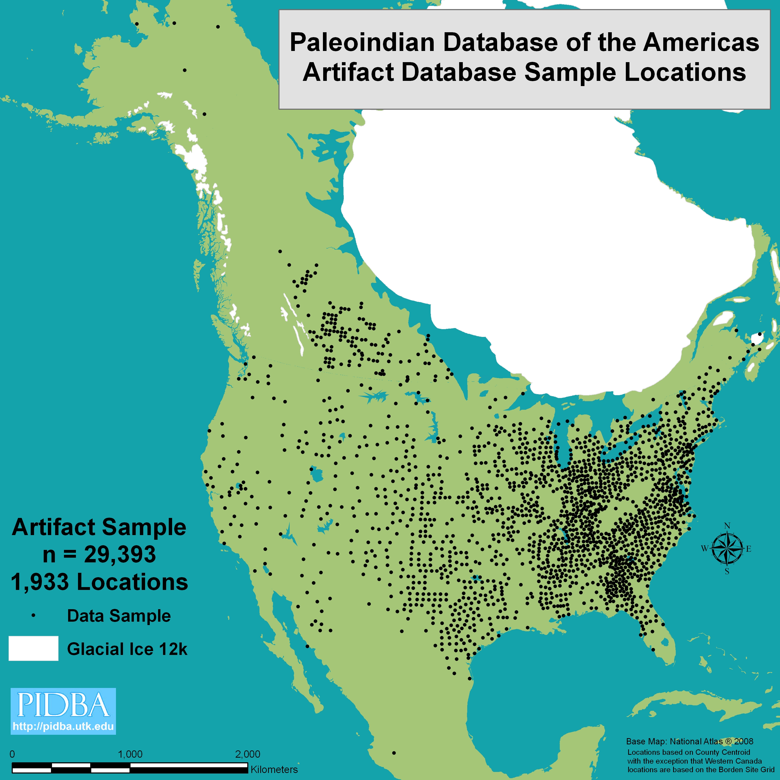 |
Displays the county centroids used in the sample and the presence or absence of information for each county in the entire locational database. |
All Fluted Points |
 |
Total number of points reported in the sample, excluding all named Paleoindian and Early Archaic typed points save for Clovis, Ross County, and Clovis Variant. This is a measure of possible Clovis points, but perhaps more accurately refers to all untyped fluted forms that have not yet been unequivocally assigned to a later fluted type like Folsom, Barnes, etc. The SAMPLE number is larger than the sum of Clovis+ Ross County+Clovis variant plus all other named varieties, because in many surveys the fluted points were not typed, and hence could not be unequivocally assigned to Clovis. |
Middle Paleoindian Points |
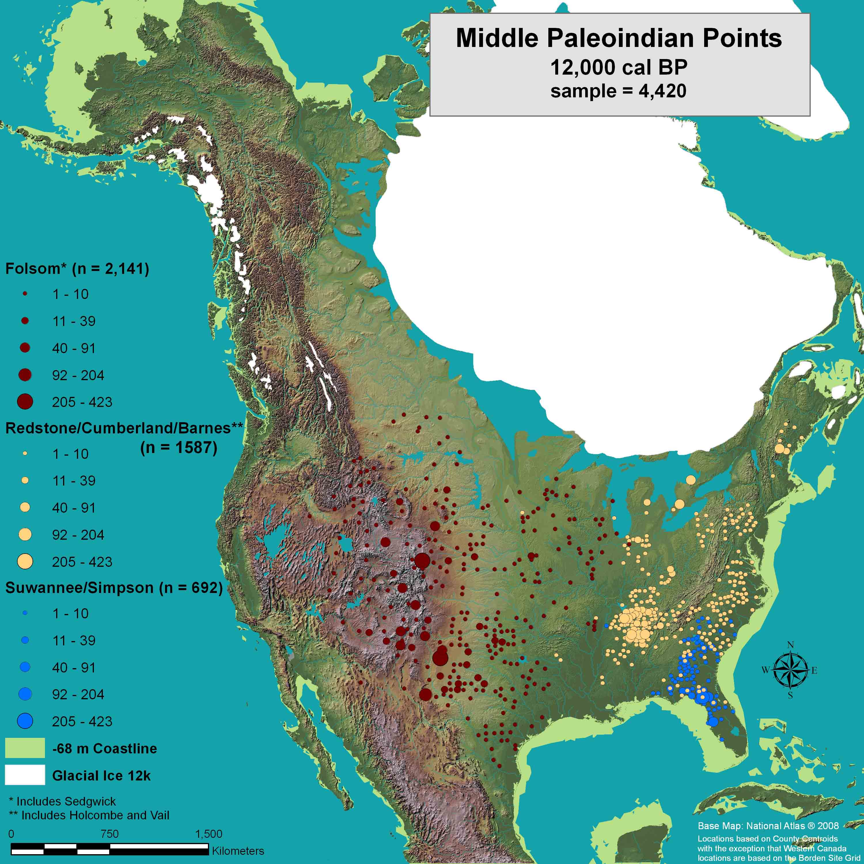 |
Image Source: Anderson et al. 2010:72. |
Distribution of Middle Paleoindian Points: Folsom, Redstone/Cumberland/Barnes, and Suwannee/Simpson |
Clovis Sample by Raw Material |
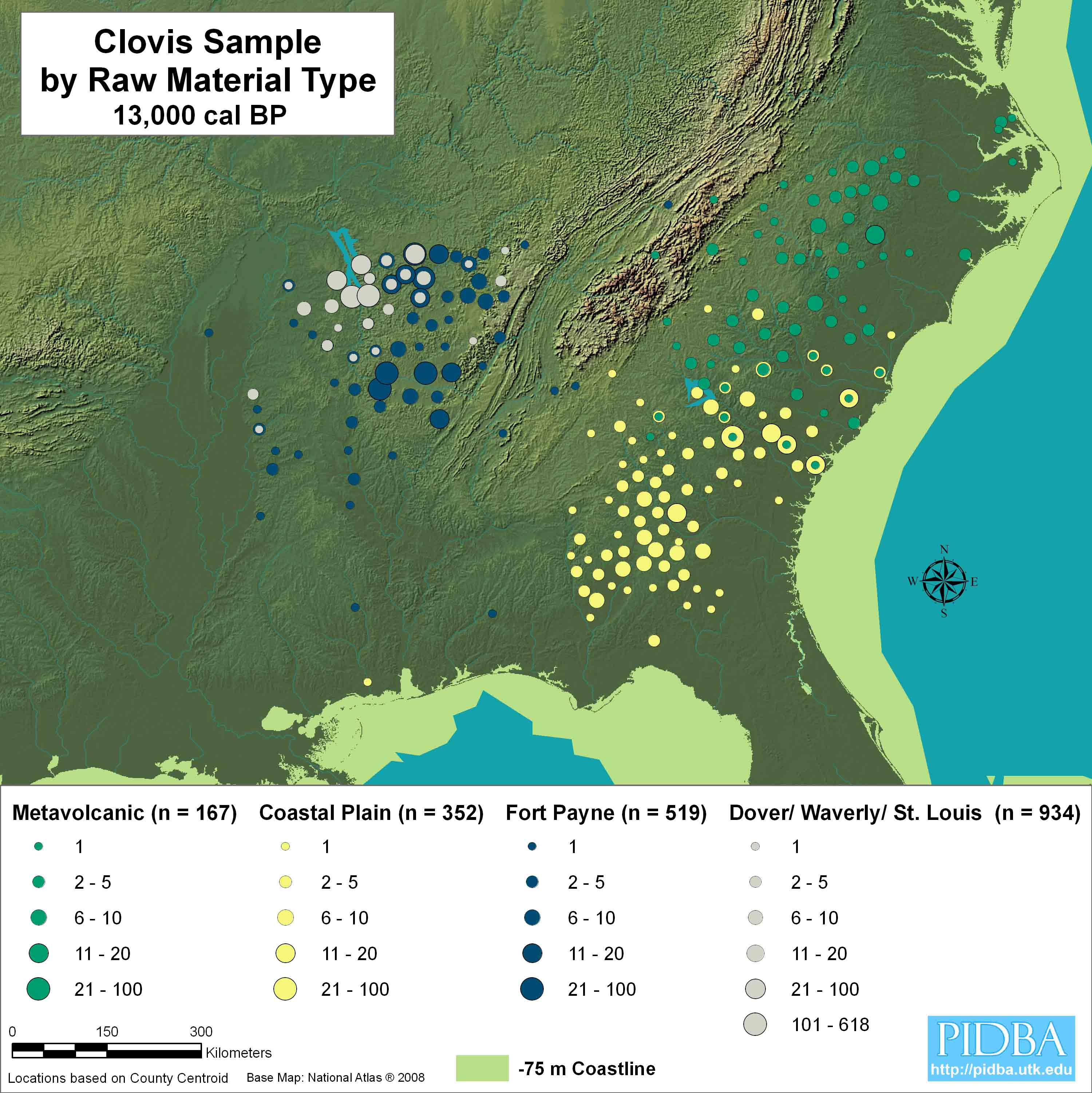 |
Image Source: Anderson et al. 2010:73. |
Clovis point incidence on four major lithic raw material categories in the lower Southeast. Most materials are found over areas several hundred kilometers in extent. |
Middle Paleoindian Sample by Raw Material |
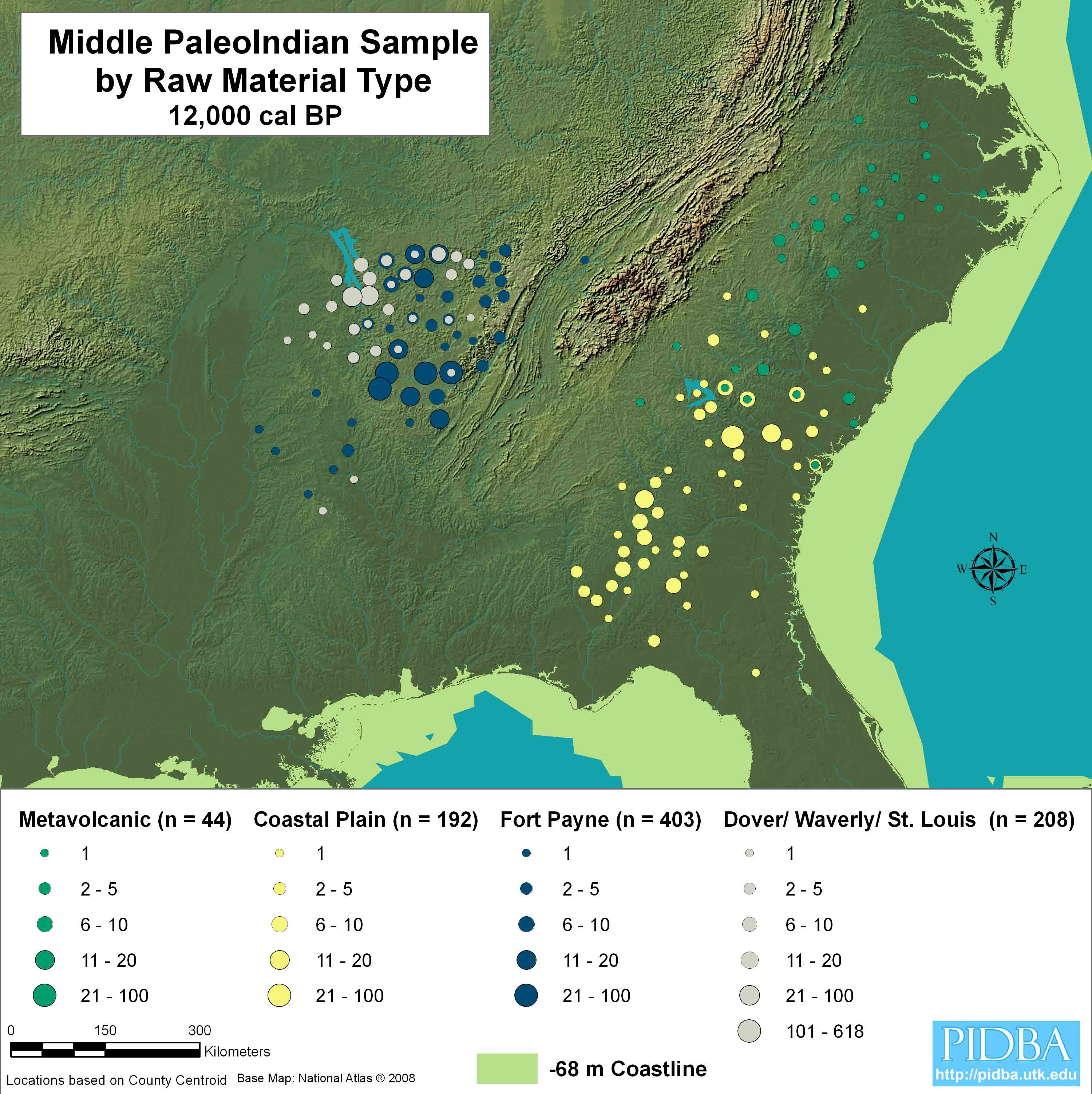 |
Image Source: Anderson et al. 2010:74. |
Cumberland, Redstone, and related ‘Full-Fluted’ horizon point incidence on four major lithic raw material categories in the lower Southeast. Most materials occur over areas that are smaller than those observed during preceding Clovis times. |
Clovis |
||
 |
 |
|
(647 KB Image in .JPG format) |
(569 KB Image in .JPG format) |
|
Total number of reported Clovis Projectile Points (For an example type description, see Justice 1987:17-21) In most surveys, fluted projectile points are assumed to be Clovis and are represented here as 'Fluted' unless they are explicitly typed Clovis or some other variety is named, such as Folsom or Cumberland. Please note the sample at this time is VERY incomplete. |
||
Cumberland |
||
 |
 |
|
(635 KB Image in .JPG format) |
(504 KB Image in .JPG format) | |
Total number of reported Cumberland Projectile Points (For an example type description, see Justice 1987:25-27) |
||
Folsom |
 |
(580 KB Image in .JPG format) |
Total number of reported Folsom Projectile Points (For an example type description, see Justice 1987:27-30) |
Quad / Beaver Lake |
 |
(622 KB Image in .JPG format) |
Total number of reported Quad and Beaver Lake Projectile Points |
These two point types were represented together because of significant overlap in their ranges, as well as their demonstrated chronological
contemporaneity at sites such as Dust Cave, AL (see Sherwood, et al. 2004). |
(For an example type descriptions, see Justice 1987:35-40) |
Redstone |
 |
(561 KB Image in .JPG format) |
Total number of reported Redstone Projectile Points (For an example type description, see Justice 1987:22) |
Suwanee / Simpson |
||
 |
 |
|
| (641KB Image in .JPG format) | (476 KB Image in .JPG format) | |
Total number of reported
Suwanee and SimpsonProjectile Points (For an example type description, see Simpson 1948: 11-15 and Bullen 1975:56) |
||
| These two point types were represented together because of significant overlap in their ranges. | ||